Scottish Association for Marine Science (SAMS) continues to work with funders and partners to progress the detailed design of proposed new active travel link between Connel and Dunbeg for pedestrians, cyclists and horse riders to use. The project is funded by the Scottish Government through the Sustrans Scotland Places for Everyone programme. Following a successful feasibility study by Arcadis, Ironside Farrar was appointed to carry out the detailed design stage and prepare a planning application for the scheme.
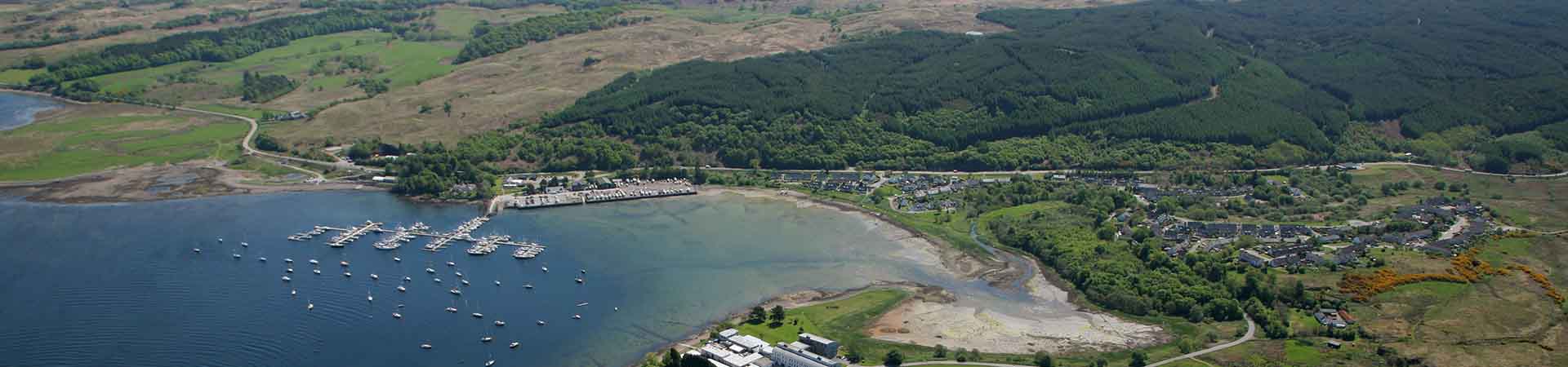
The aim of the new route is to deliver a key commuter and community link to primary education establishments, places of employment, transport interchange nodes and a range of amenities, as well as to serve recreational and long-distance users. The route is expected to link with existing paths at Dunbeg and North Connel.
The Consultation Process
The original routes came from an extensive consultation exercise carried out at the feasibility stage of the project by Arcadis. Subsequent to this Ironside Farrar have developed the proposals following discussions with affected landowners and key stakeholders including Argyll & Bute Council and Transport Scotland. Some of these discussions are still ongoing and it’s possible that the alignment of the route could still change.
The plans and sketches on display in the Route Plans describe this preferred route in more detail and are presented here to update all interested parties on the latest design proposals and progress of the project in general. We had hoped that this would be a face to face event however due to current Government advice this has not been possible.
We are not particularly seeking additional views on the project however a form is provided to allow you to give feedback to the design team. There maybe issues that were not obvious before or you may just wish to show your support for the scheme. Either way we would encourage you to leave your comments. There are also specific questions relating to the route alignment at the two sections between Poppies and Old Shore Road.
It is the intention to submit the project for planning approval in late spring/early summer and there will be further opportunity for owners, neighbours and interested parties to make their own representations at this point directly to Argyll & Bute Council.

The Connel to Dunbeg detailed design route is summarised as follows:
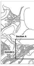
The route is approximately 3.6km long and has been split into 6 sections all with a slightly different character. There is a separate plan and cross section for each of these sections. Click on the map above to see the detailed section information.
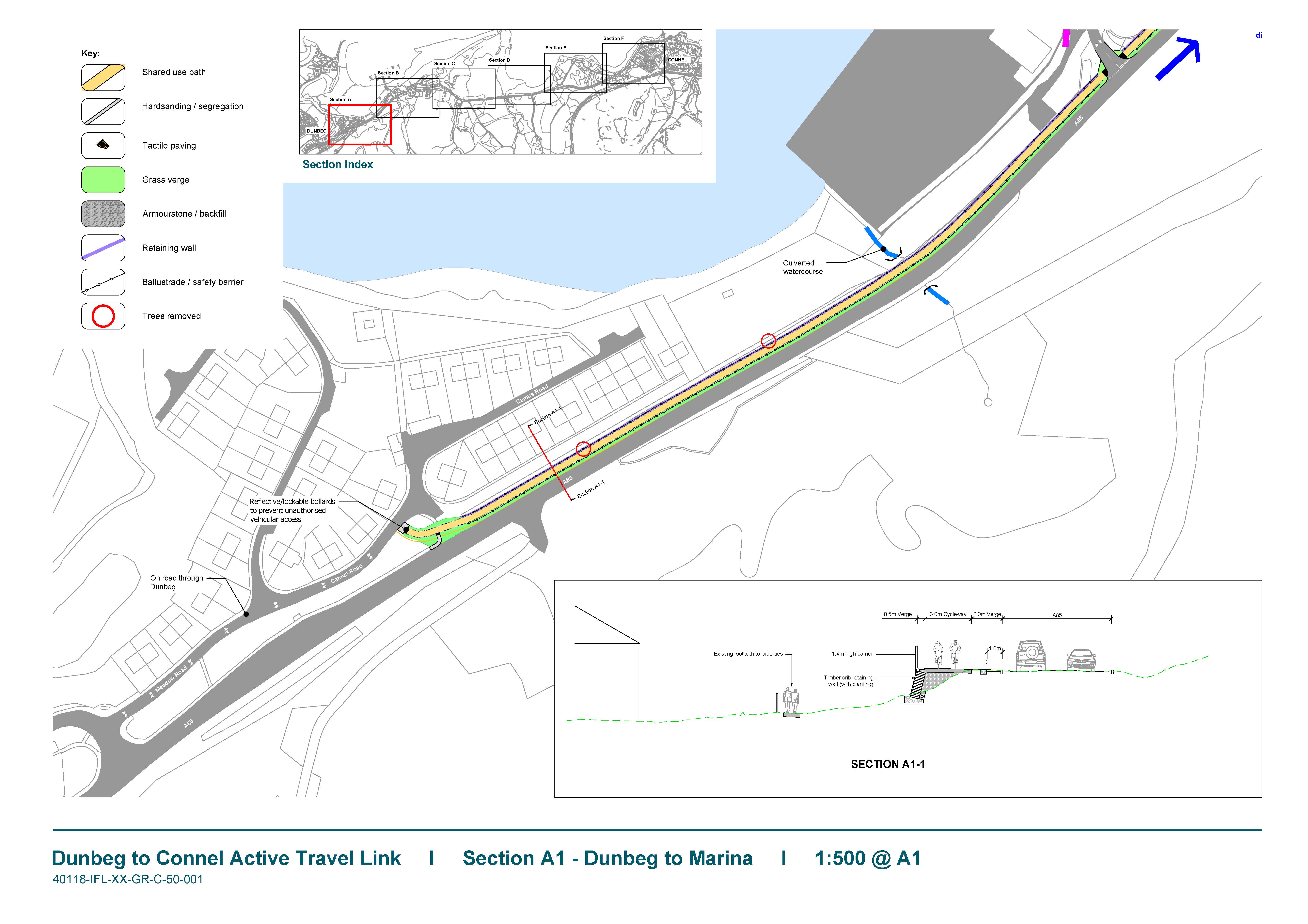
A1 Dunbeg to Marina
The existing road embankment will be widened from the Jane Road/A85 junction to Dunstaffnage Marina to allow a 3m wide footway/cycleway with a 2m verge strip where feasible; A new retaining wall will be required for much of the route and the existing safety barrier retained.
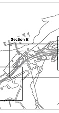
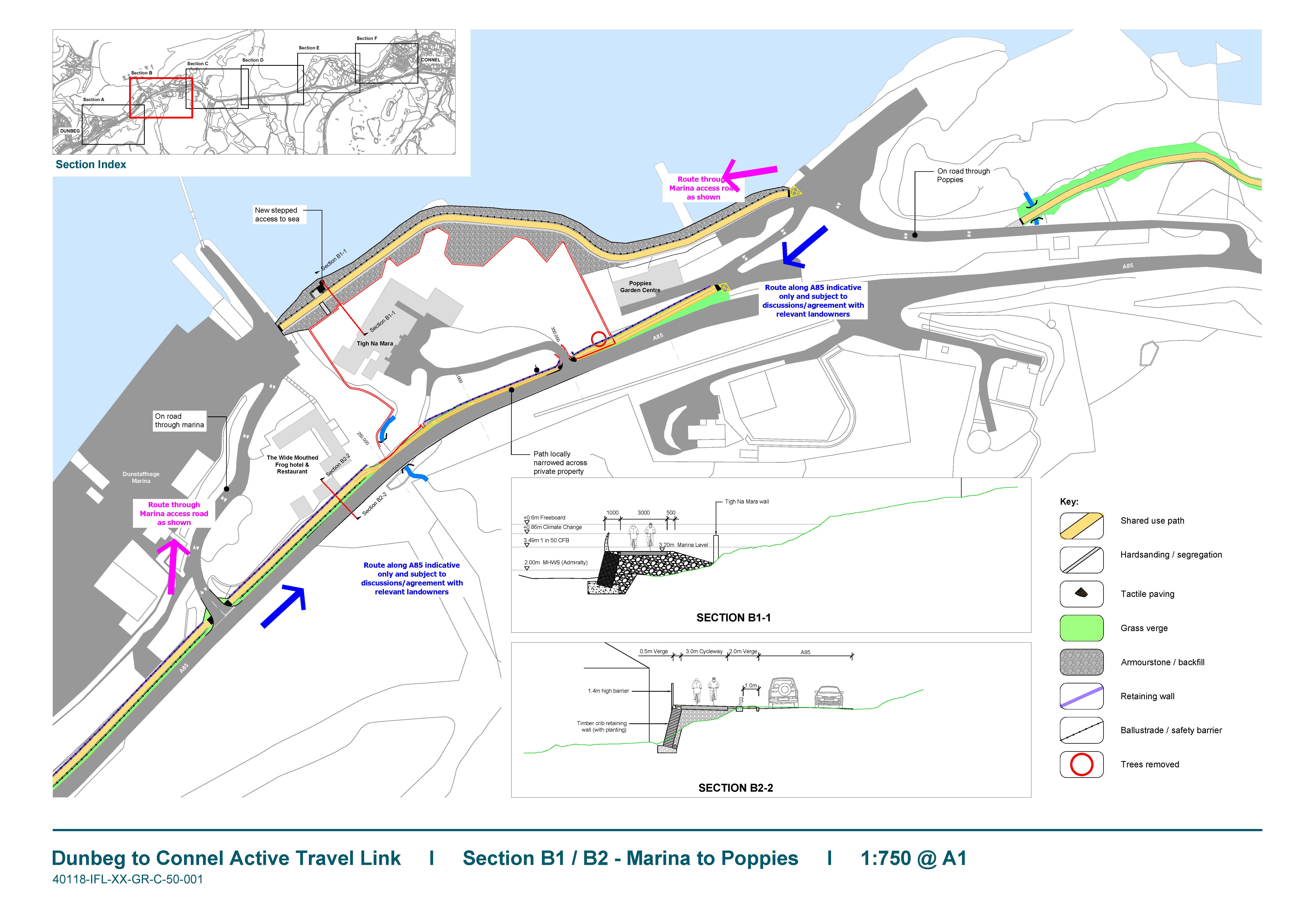
B1 Marina to Poppies
This is a difficult stretch to realise due to the lack of available land. Two options are still being examined as follows:
B1-1 Continuation of the route along the Dunstaffnage Marina Access Road; This bypasses the ‘Tigh-Na-Mara’ property via an elevated causeway on the northern side of the property, skirting the shoreline;
B1-2 The route follows the A85 but narrows considerably – possibly to around 1.5m wide or less across the southern boundary of ‘Tigh-Na-Mara’ – a length of around 100m.
Both routes then cross through ‘Poppies’ garden centre sharing part of their existing access road.
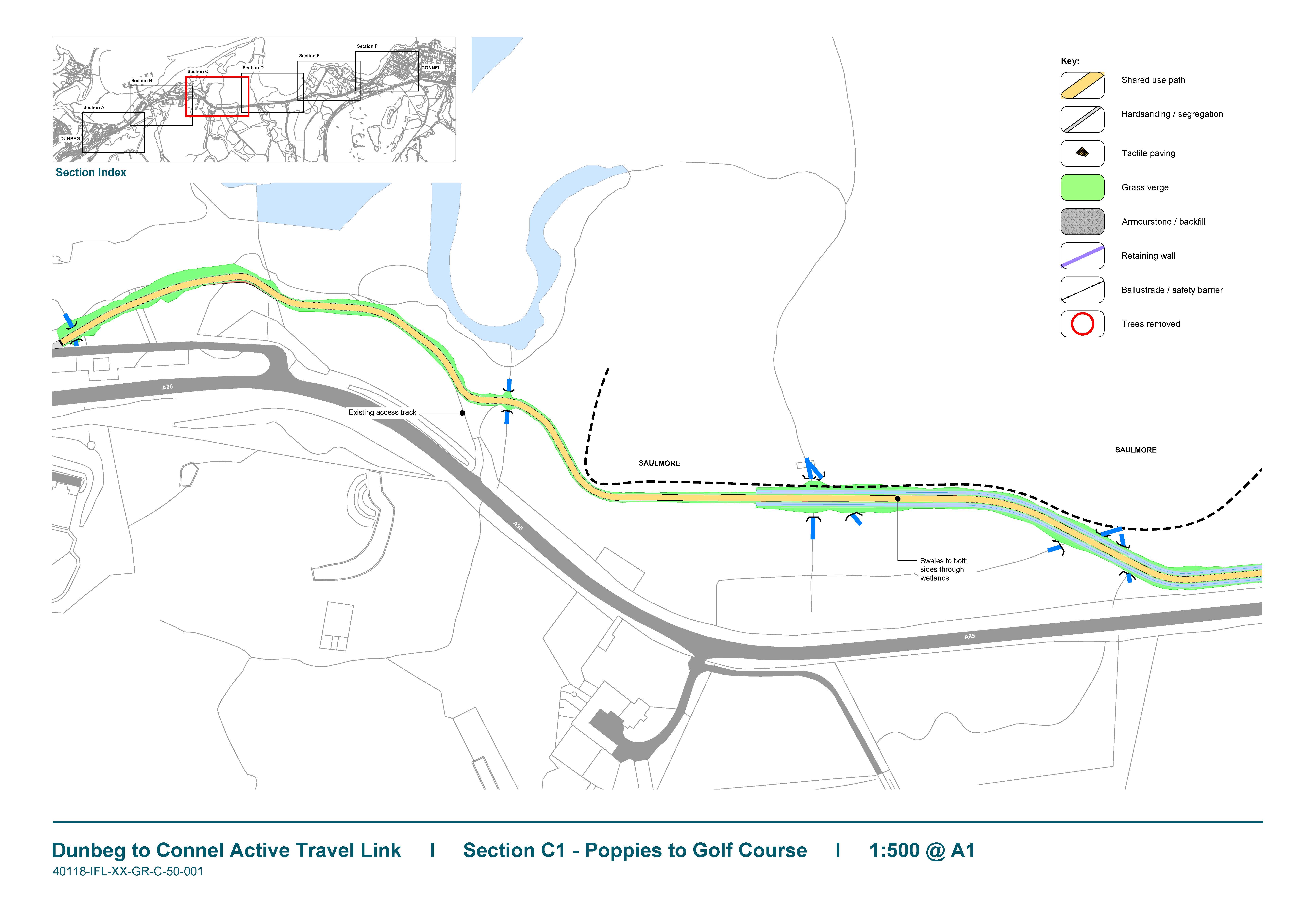
C1 Poppies to Saulmore
The route through this section is a simple 3m wide path that meanders slightly to avoid the worst of the marsh areas. The land is private and currently used for rough grazing and therefore ongoing maintenance may be an issue. To resolve this an option to more closely follow the trunk road is being considered. The route can then be easily maintained by Transport Scotland. There is a specific question on this on the feedback form.
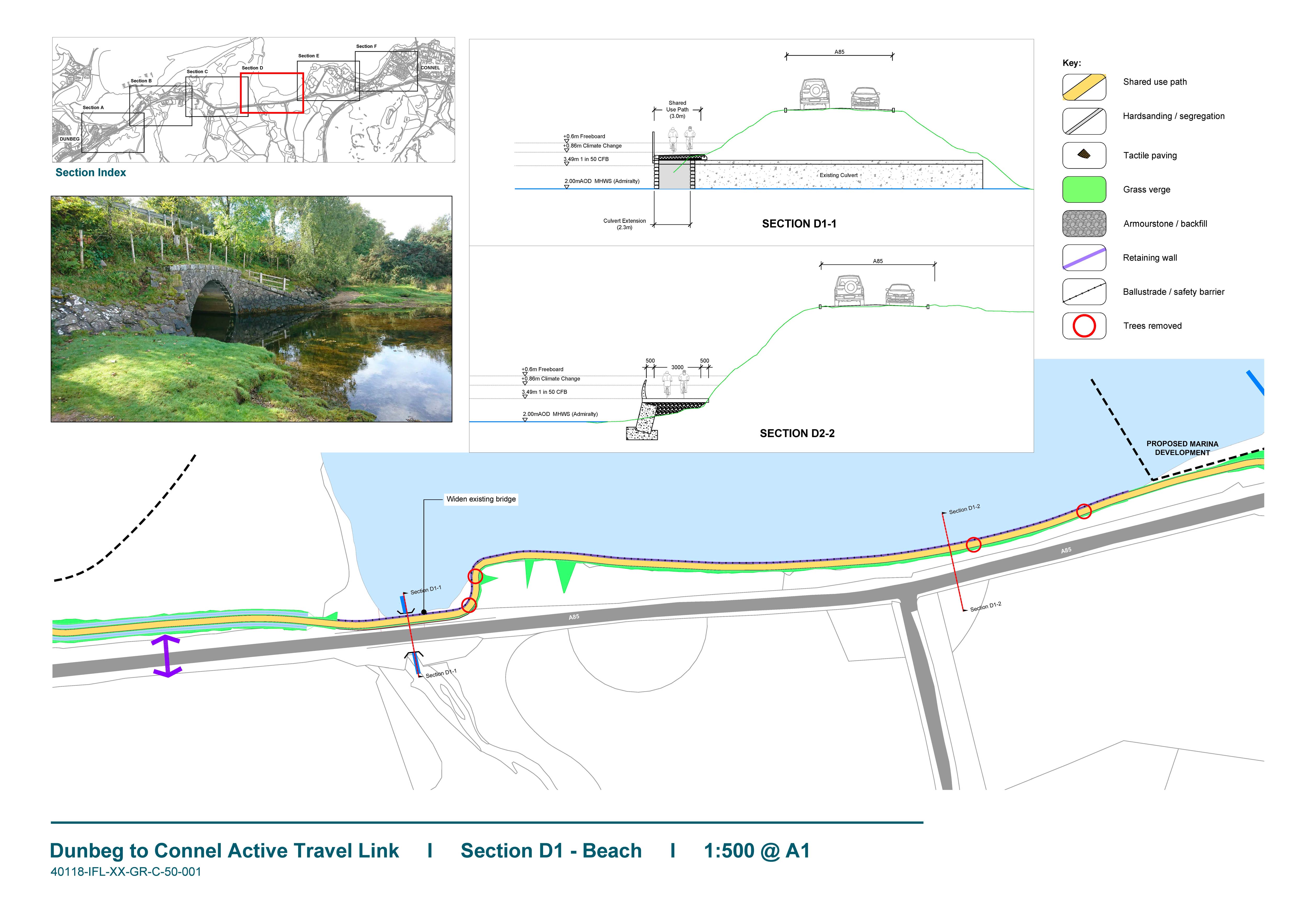
D1 Beach
This section requires crossing of the bridge at Saulmore and then follows the steep northern embankment of the A85. The proposals are to widen the bridge to allow a 3m path crossing. The route will then drop down to the beach level and follow the toe of the embankment. An alternative option immediately adjacent to the trunk road is also being considered to allow easier maintenance access. This would however require extensive works to the existing road embankment and removal of additional trees. There is a specific question on this on the feedback form.
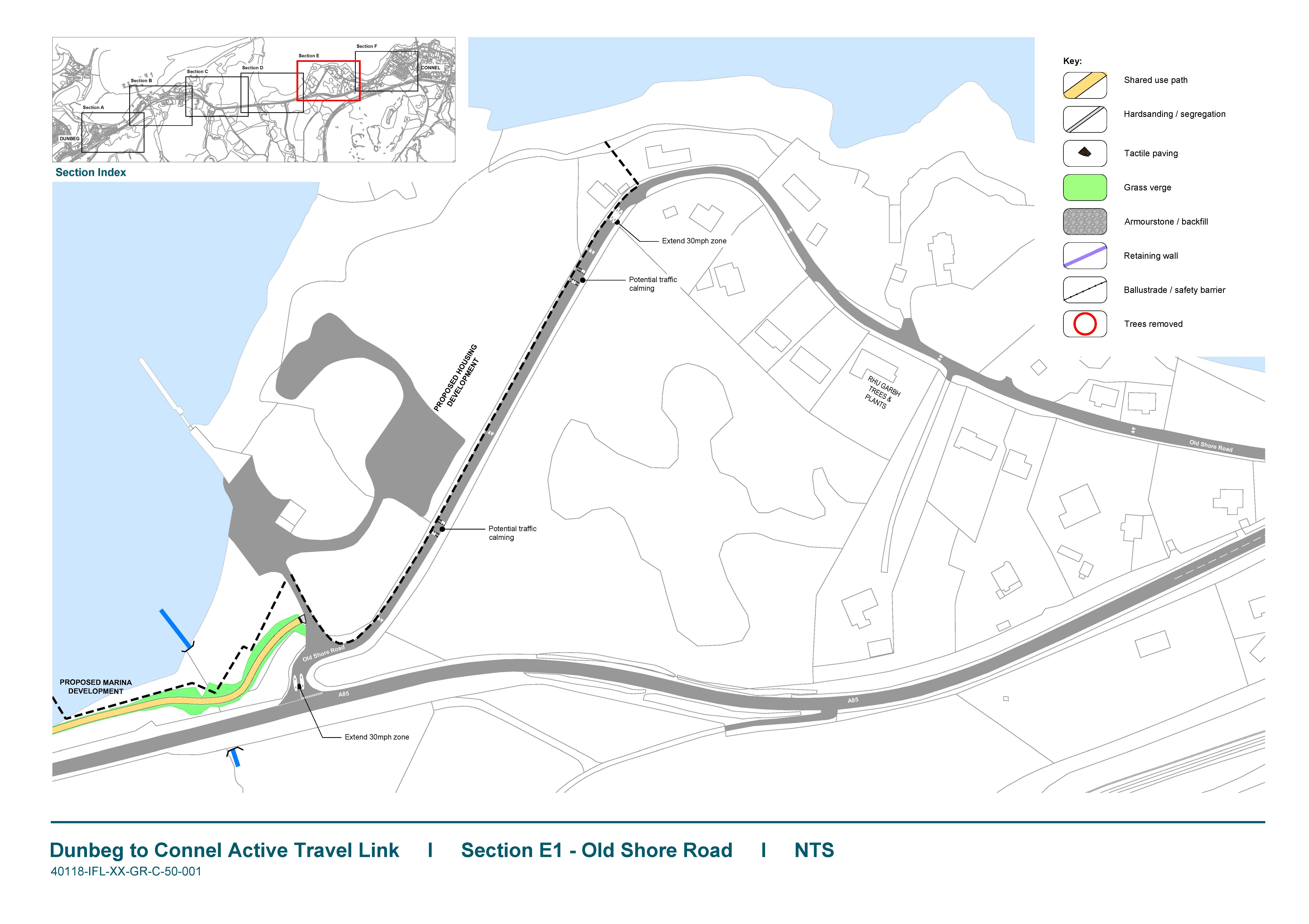
E1 Old Shore Road
The route joins Old Shore Road into Connel. The route is relatively quiet and all users would use the carriageway here. Minor traffic calming measures are being considered subject to the approval of Argyll & Bute Council Roads department.
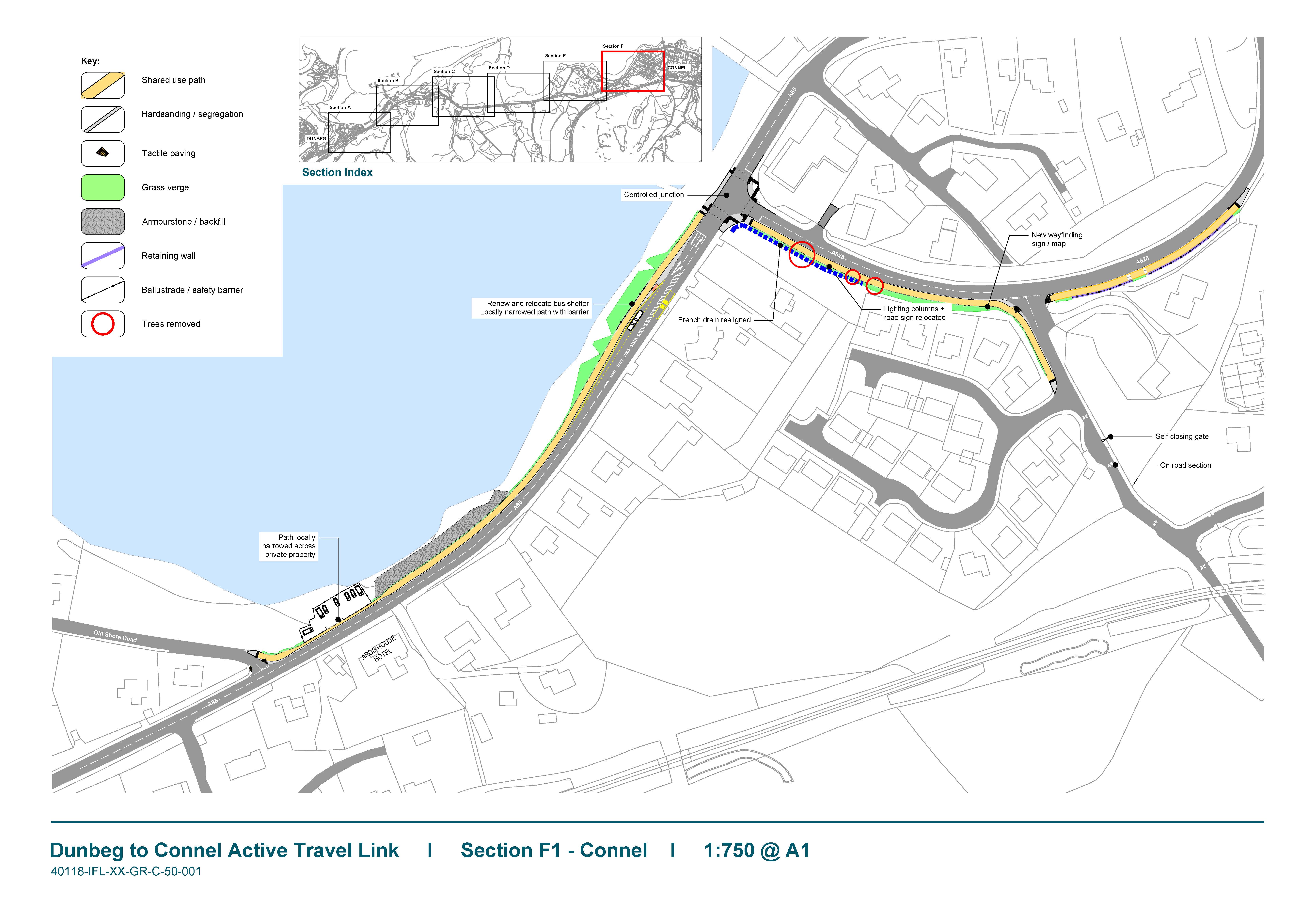
F1 Connel
The route rejoins the A85 via a widened footway along the north verge of the A85. Traffic signals are proposed at the A828 junction. The southern footway is widened where possible to around 3m up to Connel Bridge. An improved link to Connel Train Station is also provided.
Route Detail - Consultation Version
Please leave your feedback using the form below. There maybe issues that were not obvious before or you may just wish to show your support for the scheme. Either way we would encourage you to leave your comments.