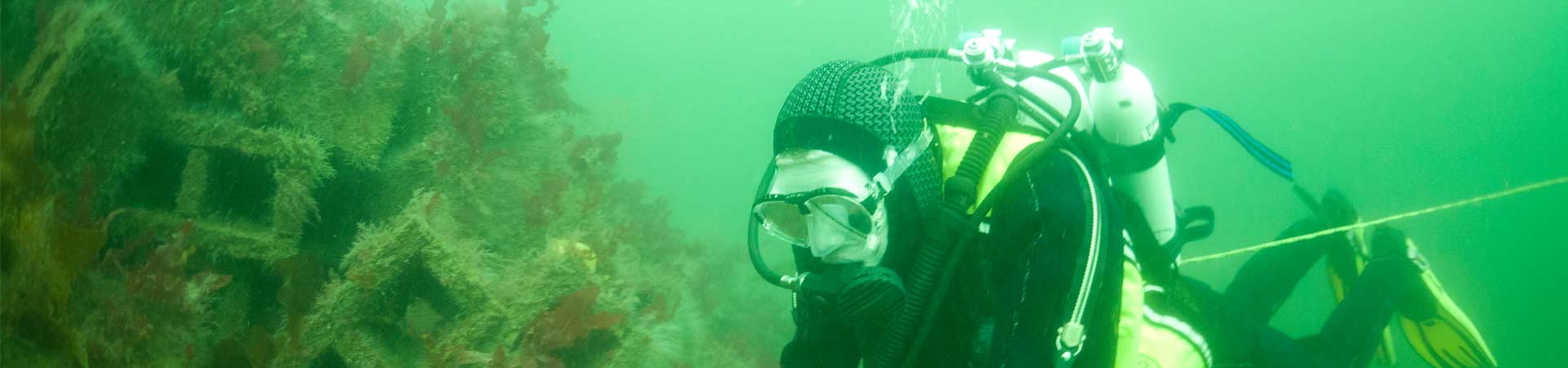

Man is increasingly intervening in the coastal zone through, for example, the construction of offshore wind-farms and coastal defence. These structures have many of the characteristics of artificial reefs. An artificial reef is any structure that is deliberately placed in the sea with the primary objective of reproducing some aspects of a natural reef.
The Loch Linnhe Artificial Reef, completed in 2006, has been designed to facilitate research into the interaction between man-made structures and their environment, including potentially beneficial effects on fisheries and local biodiversity.
The reef complex conists of five groups of six individual reefs deployed in water that is between 12 and 30 m deep. In total 175,000 concrete blocks with a mass of 6,230 tonnes have been deployed. Each of the 30 reef modules consists of 4,000 concrete blocks that are either solid or contain voids.
These pages describe the construction to provide an overview of the facility it offers for further research projects.
Licensing and location
In the UK artificial reefs are licensed under the Food and Environment Protection Act. The Loch Linnhe Reef licence required extensive consultation. Reef construction began in 2001 and was completed in 2006.
The site in Loch Linnhe was chosen on the basis that it hosted very little fishing activity, is close to SAMS and Glensanda Quarry, is sheltered from the weather and is subject to a varied current regime.
The reef complex consists of five groups of six individual reefs (30 total) deployed in water that is between 12 and 30 m deep. In total 175,000 concrete blocks with a mass of 6,230 tonnes have been deployed.
Construction
The reef blocks were made at Glensanda Quarry using low value aggregate produced as a part of the overall production of ca. 6 million tonnes per annum. Each reef consists of either 4000 solid or 4000 cavity concrete blocks equating to 200–140 tonnes respectively.
The blocks are either solid or contain two voids.
The reef is constructed by simply dropping blocks (one type per reef), from the surface, onto a target buoy. This results in a conical pile of blocks, some 3 – 4.5 m high and 15 -20 m in diameter which immediately interacts with the receiving environment and generates a highly complex habitat for benthic species.
Site characterisation
The receiving environment was extensively characterised, including acoustic ground discrimination system mapping, hydrographic surveys, including the use of Aandera current meters and acoustic Doppler current profiling.
The site is subject to a jet of water, originating from the mouth of Loch Creran, which is much stronger on the ebb tide compared with the flood tide. The SW part is typified by species preferring slower currents and muddy sediments such as Pennatula phosphorea, while the NE part if subject to strong currents and hosts fauna such as Munida rugosa hiding under stones.
SAMS scientific staff involved
Dr Martin Sayer
Project partners
The construction of the project was funded and delivered in close partnership with our local super quarry, then owned by Yeoman (Morvern) Ltd (since taken over by Aggregate Industries). The science was supported by a NERC grant from the Connect B scheme, a NERC studentship and the EU Fisheries Initiative PESCA. Newcastle University, UHI and the University of Glasgow were academic collaborators. Other support was given by Argyll and the Islands Enterprise, PADI AWARE and A&BC Leader plus.
We want to particularly recognise the support from Angela Yeoman in developing this amazing research facility.
Introduction
Cost is always major driving force in the selection of materials for use in artificial reef construction. In many parts of the world ‘second-use’ materials, such as derelict fishing vessels, cars, tyres and concrete rubble have been utilised. Many view this type of reef as legalised dumping. In the UK the Food and Environment Protection Act requires reef proponents to demonstrate the physical longevity and chemical robustness of the construction materials precluding most second-use materials.
The quarry at Glensanda produces a range of granitic aggregate products. Prior to sale all aggregates are washed generating top-quality clean aggregates and, via processing, a ‘washing plant filter-cake’ (WPFC). Sands, produced as a by-product of aggregate crushing and transport, and WPFC are currently sold at minimal profit or require disposal. These materials are ideal potential candidates for inclusion in concrete blocks.
One of the major costs in concrete manufacture is the binding agent (cement). Cement additives improve the efficacy of cements and can improve the characteristics of the resultant concrete. One of the most common additives is coal-ash which is derived from coal-fired power stations. However, coal-ash is enriched with a range of trace metals.
Our objectives in this research was to produce a concrete that was sufficiently strong (measured by compressive strength; set at 10 n mm-2) and which demonstrated negligible leaching of the trace metals derived from the inclusion of coal-ash.
The research programme first set-out to produce a robust concrete block then to establish if it leached potentially significant trace elements.
Method
Stength assessments
A standard concrete mixer was used to mix a range of concretes which were formed into blocks using wooden moulds. The proportions of sand, filter cake, fly-ash and cement were varied and the resultant block strengths assessed, using a standard industry pneumatic vice. Compressive strengths were tested over a 90 day curing period.
The optimal concrete mix was chosen on the basis of exceedance of the target strength (at 90 days) and the minimisation of cement/fly-ash. This concrete was then tested for its leaching characteristics.
Leaching
The leaching work was split into two separate experiments. We firstly wished to determine the difference in trace metal content between concrete and granite (which made up 90% of the concrete) and then test their respective leaching characteristics compared with a seawater control. Four replicates of each were characterised.
(a) Trace-metal concentrations in concrete and granite were determined by dissolving the material in acid and analysing it using the induced coupled plasma mass spectrometer (ICPMS). This machine is able to measure very low concentrations of most elements.
(b) Leaching characteristics were determined by taking samples of concrete and granite grinding them into a powder and continuously suspending them in ultra-pure artificial seawater at 16°C. Water samples were taken over a period of 104 days and subjected to analysis using ICP-MS.
Results
(i) Stength development
All concretes increased in strength over the 90 day cure period. Strength gain was negatively associated with water content and positively associated with cement/fly-ash content. The optimal block was Mix 4 which contained 5% cement and 5% fly-ash. This block met the target block strength (10 n mm-2) after approx 65 days and reached 14 n mm-2 at 90 days (Fig. 5).
The small-scale (experimental) manufacture of concrete blocks allowed the inclusion of WPFC. However, full-scale block manufacturing plant was not able to adequately mix this material. The final concrete mix, used in the Loch Linnhe Artificial Reef, contained 8% cementitious material (a proprietary blend of cement and coal-ash) and dust (material passing through the 4 mm sieve).
The concrete blocks have proved to be extremely robust; we have seen no deterioration in them over 5 years.
(ii) Trace metal concentration in concrete vs granite
Concrete contained significantly more iron, strontium, scandium, vanadium, and arsenic compared with granite (p<0.05, n=4; Fig. 6).
(iii) Leaching
Barium, iron, manganese, molybdenum, rubidium, strontium, and uranium leached in significant amounts from both the concrete and granite treatments when compared with the controls (p<0.05, n=4; Fig. 7). Conversely cadmium, lead, and zinc concentrations were lower or equivalent in both the treatments compared with the control (p<0.05, n=4; Fig. 7). In addition, the granite treatment also resulted in lower concentrations of arsenic and vanadium compared with the control. Significant differences in leaching of iron, manganese, molybdenum, rubidium, strontium, and uranium between the granite and concrete treatments were also shown ((p<0.05, n=4; Fig. 7).
Conclusions
Quarry by-products, when mixed with cement and coal-ash, can be used to manufacture concrete blocks that are physically strong, chemically inert and cost-effective.
The inclusion of washing plant filter-cake did not prevent adequate strength development but was not compatible with industrial plant.
The trace metal concentration and leaching rates from the concrete were very low. The addition of the cement effected the leaching characteristics of different element differently. Granite-derived uranium was effectively locked-up in the concrete whilst molybdenum, probably derived from coal ash, did appear to leach from the concrete but only in minuscule amounts. Elevated iron levels in the concrete are probably derived from the mixing plant.
References
Wilding, T. A. and M. D. J. Sayer (2002). "Evaluating artificial reef performance: approaches to pre- and post-deployment research." ICES Journal of Marine Science 59: S222-S230.
Wilding, T. A. and M. D. J. Sayer (2002). "The physical and chemical performance of artificial reef blocks made using quarry by-products." ICES Journal of Marine Science 59: S250-S257.
Introduction
The success, or otherwise, of reef projects is largely dependent on their location. Detailed site surveying and characterisation is, therefore, an essential prerequisite to reef construction
Acoustic methods, such as acoustic ground discrimination systems (AGDS), offer the potential to survey large areas relatively cheaply. Acoustic methods work by interpreting the nature of sound that is bounced off the seabed.
RoxAnnTM is an AGDS that interprets two echoes returning from the seabed. The first echo return (E1) is calculated from the strength of the echo after the primary return (which gives the depth indication on echosounders) has been removed. The second echo (E2) is the double echo (sea-surface to seabed reflection). Together they are used to ‘define’ sediment types (Fig. 2b) according to a classification system based on ground-truthing.
Despite the reliance on acoustic methods, throughout the surveying industry, it remains unclear as to which parameters actually determine the acoustic properties of the seabed. In addition, the temporal stability and survey-vessel speed dependence of acoustic systems are largely unknown and require further investigation.
Methods
We aimed to determine the effects of several parameters on the output from the AGDS ‘RoxAnnTM’. These parameters included sediment type (granulometry), time and survey vessel speed.
(i) Sediment characterisation: Several sediment parameters were quantified. Firstly, sediment cores were taken at 11 sampling stations throughout the sampling area. The sediment cores were subject to particle size analysis (PSA), using a sieve stack, to split the sediment into seven size fractions. Secondly, stone cover (> 30 mm) was counted, at 40 stations, along a 600 m transect (M1 – M6). Stone cover was chosen as it represented a potentially rough/hard surface that would not be possible to quantify using PSA. The granulometric data were subject to principal components analysis. PCA scores (axes 1 and 2) were used in subsequent multiple regression and path analysis.
(ii) Temporal and survey speed: Surveys over the same ground were conducted within survey (i.e with a return to the station within 4.5 hrs), between subsequent days and between months (up to a maximum of 7 months). The correlation between E1 and E2, and their association with the measured sediment parameters, were assessed. These surveys, done on different dates, were also conducted at different speeds (2, 4, 6 and 8 knots) to evaluate vessel speed effects.
Results
The site consisted predominantly of sandy-silts. There was a granulometric gradient along the surveyed transect (M1 – M6) with sediments in the south-west sector (M1) being the finest and those in the north-east being the coarsest (M6). Stone cover increased along the transect, with an exception of a drop between 375 – 500 m, from M1.
E1 and E2 were closely associated (rough areas tend to be hard) over all surveys. However, the correlation varied between 0.26 and 0.68 depending on when, and at what speed, the survey was conducted.
Stone cover was significantly correlated with both E1 and E2, during all surveys (r=0.46 – 0.81, P<0.005, n=40) but the relationship with E1 was more variable compared with E2. The relative correlation between stone cover and E1 and E2 was not consistent. Despite the consistently high correlation with stone cover, the drop in stone cover at 375 to 500 m along the transect was not reflected in a drop in either E1 or E2.
E1 and E2 were not correlated with sediment granulometry (PC1 or PC2) after the influence of stone cover had been removed. The effect of time was highly variable, over all scales examined. The within-survey drift accounted for up to 22% of the variability in E2, whilst the average drift (over all timescales examined) was 7.6%.
Vessel speed influenced E1 and E2, at all speeds during all surveys. However, the influence of speed, on both E1 and E2, was inconsistent. The magnitude of the speed effect did not necessarily correlate with the magnitude of the difference in speed between surveys.
Discussion
Stone cover showed the highest degree of predictability in respect of RoxAnn output. The overall trend in stone cover was consistently associated with E1 during all surveys and the system may be considered to have some use, for tracking this parameter. However, the lack of a response in E1 (or E2) to the marked drop in stone cover along the transect (375 – 500 m) suggests that the relationship is not a simple one. Rather, stone cover may correlate with one or more factors that determine E1 and E2. The other granulometric parameters examined (PC1 and PC2 as measures of sediment texture) did not significantly contribute to the predictive capability of the models investigated.
Our results indicate considerable differences in RoxAnnn output occur over very short time intervals, for example within surveys. This short-term variation may result in apparent differences between locations being a simple function of when the survey was done. Survey results should be interpreted carefully, especially if an area is surveyed systematically where a trend in sediment type may simply reflect a progressive drift in the output. Also, ground truthing should be conducted on each day the system is used, even when over the same ground.
Vessel speed showed an inverse relationship with RoxAnn output with the greatest effect on E2. Users may therefore expect that if an area is surveyed at a speed faster than used to calibrate the system, the bottom will appear to be both smoother and softer than it actually is.
Conclusions
Visual surveys and granulometric analysis show that the Loch Linnhe Artificial Reef site is characterised by a gradient in sediment texture, with the SW sector being muddier than the coarser NE sector. The AGDS RoxAnnTM was not very good at detecting these differences and recorded large and inexplicable variations in output, over time, and as a function of survey vessel speed. RoxAnnTM is of limited usefulness in predicting sediment texture and could not distinguish between the muddiest (M1 and S1) and the coarsest stations (M6) on the basis of particle size alone. This lack of resolution has implications for its use for community mapping as the biological communities at M1 and M6 are very different (Wilding and Sayer, 2002). This work is fully described in Wilding et al (2003).
References
- >Wilding TA, Provost PG, Sayer MDJ (2003) Assessment of the performance of the RoxAnnTM acoustic ground discrimination system. ICES Journal of Marine Science 60: 1373-1380
- > Wilding TA, Sayer MDJ (2002) Evaluating artificial reef performance: approaches to pre- and post-deployment research. ICES Journal of Marine Science 59: S222- S230
Introduction
The placement of artificial structures on the seabed inevitably results in a range of impacts. These occur primarily through the interaction between the structure and the hydrographic environment. Such interactions are likely to result in areas of both increased and decreased current speed and, subsequently, erosion and deposition.
We observed large accumulations of phytodetritus at the reef edge (Wilding and Sayer, 2002) and set out to test whether this organic material impacted the sediment and associated infauna and the extent of any impact.
Methods
Initially sediment from the reef edge (ON reef) and four meters from the reef edge (OFF reef) were sampled from two reefs (reef 53 and 64). These samples were assessed in terms of granulometric structure, organic content, Eh (redox, a proxy for oxygen content) and sediment coarseness (material >5 mm). Initial analysis (Wilding, 2004) showed that redox was the most important factor associated with changes in fauna composition. Further research was then required to establish the extent of the change in redox.
To determine the extent of the impact the range of reef modules was extended to cover the entire reef site, from the lower-energy sites (A group) to the high energy sites (D group). Measurements were taken over 20 months. To allow the large-scale monitoring of redox, both in time and space, an underwater redox probe was developed. Redox was measured at a depth of 80 mm, at the reef edge and at 1 and 4 meters from the reef edge. At each sampling time 10 readings were taken from each distance and two reef modules from each of the three groups were randomly sampled.
Results
Overall community effects
Relative similarity of the benthic infauna (molluscs and Ophiuroids) from different reefs (53 and 64) and proximities (on- and off-reef, N and F respectively) as shown by 2-dimensional non-metric multidimensional scaling ordination.
The area of the grey circles around each sample label is proportional to the degree of sediment anoxia (larger circles denote a more anoxic sediment). There are significant (p<0.05) differences between the ON and OFF stations and between reef groups.
Effect on individual members of the mollusc / ophiuroid community
Changes in sediment oxygenation and the local particle size (Redox and PS respectively) distribution were the two significant predictors of assemblage composition. Different species responded differently to changes in these parameters. For example, ophiuroids were more common in highly oxygenated sediments whilst the molluscs Thyasira flexuosa and Timoclea ovata were relatively more abundant in hypoxic sediments associated with the reef edge.
Redox as a function of distance from reef edge and time
The major trends in redox occurred irrespective of the reef group (location). Significant reductions in redox occurred at the reef edge but there were no differences in redox between 1 and 4 m. Redox was, overall, lower in the summer and autumn, particularly at the reef edge. The range in redox was higher at the reef edge compared with the 1 and 4 m stations indicating a patchy distribution of the major impacting factor identified by redundancy analysis.
Conclusions
The main impact occurring as a consequence of the placement of the Loch Linnhe Artificial Reef is the periodic and seasonal reduction in sediment oxygenation occurring at the reef edge. This reduction is closely associated with the accumulation of phytodetritus at the reef edge. This is likely to occur as a consequence of reduced current flow at the reef-edge.
A number of benthic infauna species respond to organic enrichment. The ophiuroids tend to decrease at the expense of species such as Corbula gibba, Hiatella artica, Mysella bidentata, Thyasira flexuosa and Timoclea ovata which appear to thrive in conditions of reduced oxygen concentration associated with increased organic input. Reef proximity did not result in granulometric changes.
Seasonal analysis showed a clear seasonal trend in sedimentary redox. This was associated with the warmer water conditions of the summer and autumn and the deposition of phytodetritus. Under such conditions, where bacterial breakdown is occurring quickly and where oxygen solubility is relatively low, sedimentary isolation under phytodetritus is likely to induce sediment hypoxia. Regardless of season, and whether the reef was located in high- or low-current regimes, the effect of on sediment oxygenation was not detected beyond 1 m from the reef edge.
The impact of the Loch Linnhe Artificial Reef, on the oxygen status of the receiving sediment, is therefore restricted to a small halo around each of the reefs, particularly those exposed to low current regimes and where there is a ready supply of phytodetritus. The alteration of near-reef sediments may have implications for the physical and chemical longevity of the reef-construction material.
Acknowledgements
This research was supported by NERC grant NER/D/S/2000/01307. The Loch Linnhe Artificial Reef is being constructed by Foster Yeoman Limited for which we are grateful.
References
- >Wilding TA (2006) The benthic impacts of the Loch Linnhe artificial reef. Hydrobiologia 555: 345 – 353
- > Wilding TA, Sayer MDJ (2002) Evaluating artificial reef performance: approaches to pre- and post-deployment research. ICES Journal of Marine Science 59: S222-S230
- > Wilding, T. A. (2014). Effects of man-made structures on sedimentary oxygenation: Extent, seasonality and implications for offshore renewables. Marine Environmental Research 97: 39 - 47.
Measuring habitat complexity
The research described here was based at Newcastle University, jointly supervised by Tom Wilding, Martin Downie and Matt Bentley, and aimed to quantify the habitat complexity offered by the artificial reef made using contrasting block designs.
Introduction
The association between habitat complexity and bio-diversity/productivity is well established. Habitat complexity is scale- dependent and some habitats only offer high complexity at certain scales. The non- subjective assessment of habitat complexity can be approached in several ways but many are based on comparisons between the linear distance between two points and the same distance measured with different step-lengths (perceived distance). Where the relationship between (log) perceived distance and (log) step-length is constant the surface complexity can be described by a single metric, the fractal dimension (D). D, for a profile, varies between one (flat surface) to two (infinitely convoluted). Many natural surfaces (for example corals and rocky surfaces) have a fractal dimension of around 1.1 (Bradbury and Reichelt, 1983) whilst mussel beds have been recorded to have D values of about 1.5 (Commito and Rusignuolo, 2000).
Measuring step-length dependent distances can be approached in a number of ways including the use of profile gauges to reproduce surface profiles and adjustable dividers or chain links of various sizes to delineate step-length. These techniques are cumbersome and time- consuming, particularly underwater and are only appropriate over limited scales.
Our objective was to develop a calibrated system that was rapid and easy to use, even underwater, and capable of measuring complexity at a broad range of scales.
Method
Step-length dependent distances were measured using a distance-wheel fitted with different sized wheels. The distance was calculated as the number of rotations, which was recorded by a magnet-induced counter multiplied by the wheel circumference. This gave a scale dependent estimate of distance across a given surface.
Calibration
The novel ‘distance-wheel’ system was calibrated with a curve of known complexity. The curve was designed to emulate the angular nature of the concrete blocks and to be at a relevant scale. For every halving of the step-length the distance travelled along the curve increased 1.5 times. This gave it a fractal dimension of 1.585.
Calibration discussion – the perceived length closely matches the theoretical length at the larger scales. However, the measured length underestimates the actual length, at smaller scales, as a consequence of the ‘stepping-over’ of sharp angles by the wheel as it was rolled along. This issue is common to all step- based techniques of measuring scale-dependent distance.
Results
Changes in pereived distance as a function of step-length over the two types of reefs (simple blocks - solid line; complex blocks - hashed line; bars show 95% confidence limits). The complex blocks offer increased complexity, but only at scales <500 mm.
Changes in fractal dimension perceived distance as a function of step-length over the two reefs. The greatest change in complexity occurs at the scale 253 - 511 mm.
Conclusions
The artificial reefs offer considerable habitat complexity at scales of between 253 and 511 mm. This is particularly apparent on the complex block reefs. The maximum fractal dimension of ca. 1.4 is well in excess of that reported for coral reefs. Reefs made using complex blocks offer additional habitat complexity compared with simple block reefs but only at scales <512 mm. Cohorts of individuals exploiting habitat space on the complex reefs, at scales <512 mm, are likely to suffer considerable reductions in habitation availability as they outgrow the 500 mm habitat. This may limit the habitation of the artificial reefs by the largest members of the epibenthic megafaua.
References
Wilding, T. A., E. J. L. Palmer and N. V. C. Polunin (2010). "Comparison of three methods for quantifying topographic complexity on rocky shores." Marine Environmental Research 69: 143 - 151.
Wilding, T. A., C. A. Rose and M. J. Downie (2007). "A novel approach to measuring subtidal habitat complexity." Journal of Experimental Marine Biology and Ecology 353(2): 279-286.
Acknowledgements
This work was funded jointly by the University of Newcastle and SAMS through the NERC Connect B scheme.
Introduction
The coastal zone is both economically and socially crucial to much of the global community but under increasing threat from climate-change induced rises in sea-level and storm activity. The traditional approach to managing coastline erosion is to build breakwaters, groynes or dykes or to undertake non structural approaches e.g. beach feeding.
Recently there has been increased interest in the concept of building artificial reefs as a means of coastal defence. In addition, in response to climate-warming concerns there are increasing numbers of offshore wind-turbines some of which are protected, at the base, from scouring by the placement of boulders and rocks, effectively making them artificial reefs.
The deployment of artificial reefs, for whatever purpose, will alter the physical and biological features of the receiving environment, for example through changes to the local and regional hydrodynamic regimes. This is likely to have consequences to any biological assemblages using the new structure by affecting larval supply and the delivery of food and oxygen.
The purpose of this research was to determine the flow patterns around models of the Loch Linnhe Artificial Reef in order to inform and direct future research looking at the distribution of fauna on artificial structures.
Methods
Multi-beam sonar was used to visualise the reefs, including reef A2c (Fig. 4). This was then used as a basis for the fabrication of a 1/20th scale model of the external topography of the reef that was used as a mould. The final test model was completed) by inverting the fibreglass mould and filling it with 1/20th scale blocks.
The completed model was placed in a 1 m deep laminar flow tank and subjected to a linear current of 0.2 m s-1. The current speed and direction around the reef-model was visualised using a dye-tracer and quantified using a Vectrino acoustic Doppler velocimeter.
Results
The flow visualisation revealed flow acceleration occurring around the sides and over the top of the reef. Dye released at the level of the top of the reef, was swept up over the reef and then downwards into vortex behind the model. Dye released at the bottom moved around the reef perimeter and accumulated behind the reef in the region of turbulence. This turbulent region was extensive.
Acoustic Doppler profiling of the current around the reef showed moderate acceleration over the top of the reef model. Behind the reef, the flow breaks into a turbulent flow probably consisting of Von Karman trail vortices, as evidenced by the reverse and upward direction of the flow near the bottom of the model. This area of reverse flow behind the reef is likely to occur as a consequence of global flow separation occurring on the reef: as the water flows over the top of the reef a pressure gradient is produced along which, at some critical point (separation point), the flow separates generating turbulence. The reverse/ upstream flow seen immediately after the reef peak and continues some-way behind the reef, for example, at X27, where the flow is reversed at all measured heights except at Z25.
Conclusions
The reef induced an area of turbulent water flow behind it resulting in flow-reversal. The area of turbulence was significant (possibly as large as the reef itself).
The results indicate that artificial structures not only add to local habitat complexity through their physical presence but also through their interaction with the local hydrological conditions. There is likely to be orientation-dependent differences in the extent of exposure to currents. This is likely to have consequences for the colonisation of artificial structures and their utilisation by commercial species.
References
Al-Bouraee, Y. (2013). Tidal hydrodynamics on the Loch Linnhe Artificial Reef. PhD, University of Newcastle.
Aston, Z. (2006). Modelling and Measuring Water Motion on the Loch Linnhe Artificial Reef - (i) Potential Biological Effects and (ii) Implications for Coastal Hydrodynamics MRes thesis, University of Newcastle.
Acknowledgements
Our thanks to Foster Yeoman Limited who constructed the Loch Linnhe Artificial Reef and to Craig Brown for supplying the multi-beam acoustic data.
Toxisarcon alba - a new-to-science discovery at the Loch Linnhe Artificial Reef site

Introduction
The Loch Linnhe Artificial Reef programme was initiated in 1998 with a view to starting deployment operations in 2000. During the intervening period baseline survey work was conducted in the proposed construction area. These pre-deployment data (Wilding and Sayer, 2002) were produced in order to allow pre- and post-deployment comparisons and consisted, in part, of visual transect surveys. During these surveys an unusual novel species of foraminiferan was discovered (Wilding, 2002). This species, subsequently named Toxisarcon alba, is one of the largest protistan cells known.
Foraminifera (forams) are primitive, single- celled organisms. They are found in most marine environments ranging from the deep oceans to marshland. Pelagic species have a crucial role in marine ecosystems being important predators of phytoplankton.
A majority of described forams have tests (shells). When they die, marine forams sink to the bottom of the sea and make an important contribution to the sediment. Pelagic, testate species are useful as an indicator of the environmental conditions prevalent at their time of deposition. This is used by oil prospectors to help them find oil.
Much less is known about forams that do not posses tests. These species do not form fossils and are frequently amorphous and difficult to describe. However , the advent of molecular taxonomy has enabled even the most difficult species to be classified.
Here the aim is to...
- >describe the environment where T. alba are found and their geographic distribution
- >describe their appearance in situ and their amazing behaviour when maintained in laboratory conditions
- >comment on their in situ motility
- >consider their respiration rates and diet
Geographical distribution, appearance and behaviour
This species has only been found on the Scottish west coast. The first described specimen came from Loch Linnhe (the current southern limit) and it has subsequently been observed as far north as Loch Laxford in the NW of Scotland.
T. alba has only been found in poorly sorted, muddy sands, typically found near the entrance to sealochs. The density of visible cells varies both spatially and temporally. It is most easily found between spring and autumn and can reach densities of several individuals per m2. Typically, it is found buried just beneath the sediment surface. Individuals of T. alba are easily collected in the field and subsequently maintained in aquaria. When kept in high densities many individuals adopt a very different behaviour. A majority of the cells rise to the surface of sediment, some start to ‘crawl’ around the aquarium or, very occasionally, form a dense mycelial-like mat.
Perhaps the most striking behaviour observed in T. alba is where it adopts the ‘spheroid’ morphotype. Here the cell completely extricates itself from the sediment, either by climbing up a support or simply removing itself from the sediment and lying on the sediment surface.
Field measurements
T. alba is so large that individuals can be measured in the field. The pepper-pot mounds, under which individuals are found, range in diameter from 10 – 35 mm (mostly around 20 mm). Uniquely individual T. alba can be tracked in the field (assisted using a small ‘flag’ to mark their location) and their motility monitored week-by-week. Most cells move between 50 and 200 mm per week, a staggering distance for a single-cell crawling through sediment.
The development of the spheroid form is associated with an increase in water content in the cells, the proportion of water increasing from ca. 65 to ca. 85%. When completely detached from the sediment (Fig. 6) the cell has virtually the same density as seawater and is easily moved by the slightest of water currents. The spheroid form may, therefore, have a dispersive role.
Toxisarcon alba is so large that the respiration rates of individual cells can be measured using a fuel-cell couloximeter, normally used to measure respiration in multicellular organisms. T. alba respiration was monitored, at 20oC, and compared with the results from other protists including forams. Published data indicates a strong relationship between cell size and respiration rate. The size of T. alba allows us to test whether this relationship still holds with cells that are three orders of magnitude larger than previously tested species.
The specific respiration rate was much higher than that observed in other forams (Hannah et al, 1994) suggesting that T. alba has a much higher metabolic rate than expected. Stable isotope analysis indicates that bacteria and algae are the main food source for this metabolically active cell.
Conclusions
- >T. alba is a massive (10 – 100,000 times as large as most protists), naked foraminiferan
- >It is locally common in highly oxygenated, poorly sorted, shallow marine sediments
- >Being easy to collect and maintain it is an ideal model species for benthic foraminifera
- >It is a very active cell, having a higher than predicted specific respiration rate
- >T. alba feeds on bacteria and algae.
References
Hannah F, Rogerson A, Laybourn-Parry J (1994) Respiration Rates and Biovolumes of Common Benthic Foraminifera (Protozoa). Journal of the Marine Biological Association of the United Kingdom 74: 301-312
Wilding TA (2002) Taxonomy and ecology of Toxisarcon alba sp. nov. from Loch Linnhe, west coast of Scotland, UK. Journal of Foraminiferal Research 32: 358 - 363
Wilding TA, Sayer MDJ (2002) Evaluating artificial reef performance: approaches to pre- and post-deployment research. ICES Journal of Marine Science 59: S222-S230